Skyline Watershed Ridge Trail Is Open. Read This First
The six-mile Skyline Watershed Ridge Trail opened on August 24 after twenty-eight years in the pipeline. Free permit, 29 parking spaces, no dogs, and it dead-ends at a fence.

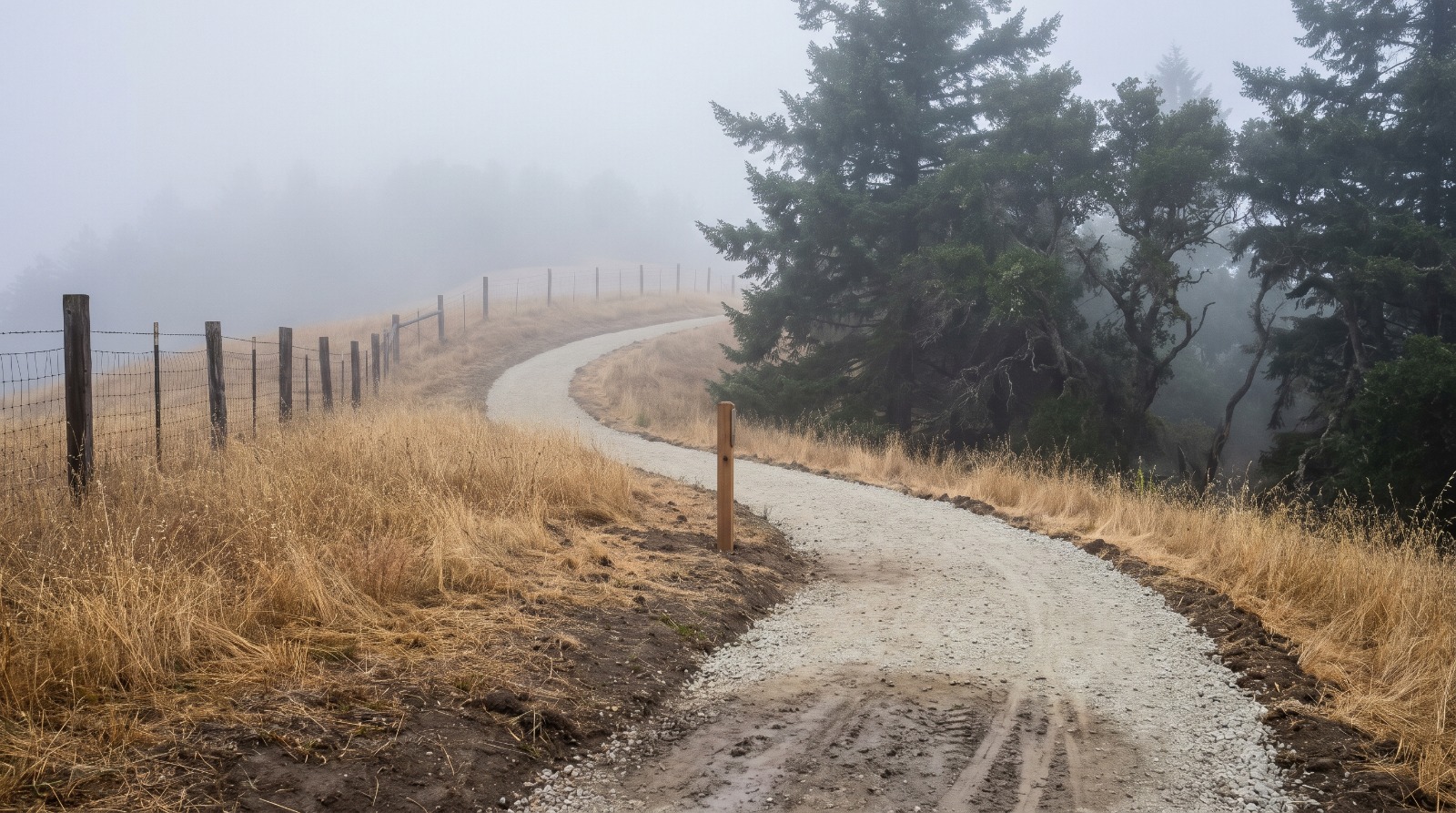
The new crushed-gravel Skyline Watershed Ridge Trail curving along a foggy ridge in the San Francisco Peninsula Watershed above Skyline Boulevard. Photo: Houseberry
The Skyline Watershed Ridge Trail opened on Monday, August 24, 2026, six miles of new public access along a Peninsula ridgeline that has been closed to unguided visitors for most of a century. The permit is free and takes a minute online. The gate is open 6 a.m. to 6 p.m. Dogs are not allowed. And here is the part almost nobody has printed: the trail dead-ends. Six miles out, six miles back, and no way through at the far end.
That is not a complaint. It is the single most useful thing to know before you drive up Highway 92 with a plan in your head, and it appears in exactly one place in the public record, on the Bay Area Ridge Trail Council's own page, in a single line. Everything else you have read about this trail is accurate and incomplete.
The permit turned out easier than the plan promised
You need a permit, and it costs nothing. It runs through the SFPUC's watershed permit portal, is good for the calendar year, and covers a party of up to six people. There is no cap on how many permits get issued. The SFPUC has been clear that the permit exists so the agency can understand how the trail is being used, not to ration it.
When the commission approved this project back in 2021, the announced plan included a required educational tutorial on protecting watershed habitat and drinking water quality before a permit issued. That tutorial does not appear anywhere in the live 2026 permit listing. Somewhere between approval and opening, the friction came out. If you were expecting a quiz, you are not going to get one, and this is one of the rare cases where a public agency shipped something simpler than it advertised.
What you cannot bring is where the real rules live. Hikers, runners, cyclists and equestrians are all welcome, and the trailhead lot was built with five trailer spaces specifically so horse trailers could use it. Motorized vehicles are prohibited, and the SFPUC spells out that this includes electric bikes and scooters. Dogs are not allowed at all, which is the watershed-wide rule and not a new restriction invented for this trail. Service animals are the exception. If your hiking is dog hiking, this trail is not for you, and no workaround exists.
Two watershed trails, opposite sides of Highway 92, and no way to walk between them
The most common confusion right now is between this trail and the Fifield-Cahill Ridge Trail, which has existed since 2003 and works nothing like it. They are both SFPUC watershed trails on the same ridge. That is where the similarity stops.
| Skyline Watershed Ridge Trail | Fifield-Cahill Ridge Trail | |
|---|---|---|
| Where | South of Highway 92 | North of Highway 92 |
| Length | 6 miles one way | About 10 miles |
| Access | Self-guided, free annual permit | Docent-led tours only, reservation required |
| When | Daily, 6 a.m. to 6 p.m. | Wednesdays, Saturdays and Sundays |
| Group size | Up to 6 per permit | Capped at 20 |
| Opened | August 2026 | 2003 |
They face each other across Highway 92 and there is no pedestrian crossing between them, so you cannot hike from one to the other. Two trails, one ridge, two entirely different experiences, and a state highway in the middle. Pick before you leave the house.
Twenty-nine parking spaces is the real limit
The permit does not cap visitors. The parking lot does. There are 29 spaces at the trailhead on Skyline Boulevard just south of the Highway 92 junction, near Skylawn Memorial Park: 22 standard, five for trailers, two accessible. Free, first come, first served, no reservations.
Twenty-nine spaces for a trail that serves the entire mid-Peninsula is going to be the binding constraint on a clear Saturday in October, and the gate hours make it worse rather than better. Six a.m. to 6 p.m. sounds generous until you are pacing a twelve-mile round trip with about 1,200 feet of elevation change and grades that hit 23.5 percent in places. Arrive at eleven, take your time, and you are doing math on the way back. There is no drinking water anywhere on the trail and two vault toilets, at mile markers two and five.
If driving is the problem, SamTrans Route 294 runs from Caltrain's Hillsdale station toward the ridge, which is a genuinely useful option and one almost nobody will take. Go early on a weekday if you can. That is the whole strategy.
What a ridge trail does and does not do for a neighborhood
We wrote about this trail in June, before it opened, and called it 5.4 miles. That figure came out of the planning documents. The trail that opened is six miles one way, and it adds 5.5 miles to the Bay Area Ridge Trail network, because not every foot of it carries the Ridge Trail designation. Both numbers are in circulation. Ours was the wrong one, and correcting it in public seems better than quietly editing the old page. You can still read our earlier piece on the trail for the background on how it got approved.
The other thing worth revising is the instinct to turn a trail opening into a property story. It is tempting, and it is mostly wrong. Amenity scores in our data measure what sits near your door, which is why Woodside proper carries a 4.5 out of 5 on amenities and Emerald Hills, a few ridgelines east, carries a 3.7 while ranking second of the fifteen neighborhoods we score in Redwood City. A trailhead at a highway junction twenty minutes up the hill does not move either number, because it is not near anyone's door. Nothing is. There is no walk-up neighborhood access to this trail at all.
What it does change is the weekend map for a large part of the Peninsula, and that is a real thing even though it does not show up in a comparative market analysis. When Tunitas Creek Beach opened we made the same point about parking being the thing that decides whether an amenity is usable. It applies again here, harder, with 29 spaces instead of a beach lot.
Twenty-eight years, and what is still missing
This project entered California environmental review in August 1998, under state clearinghouse number 1998082030. The commission approved it in May 2021 with construction targeted for 2022 and completion for 2023. Construction actually began in April 2024. It opened in August 2026. Call it twenty-eight years from first filing, or five years from approval against a two-year plan, and either way it is a long time for six miles of gravel.
The delays were not bureaucratic theater. This watershed supplies drinking water to about 2.7 million people, sits inside a 23,000-acre state fish and game refuge, and required wildlife-friendly fencing and durable construction that SFPUC staff described as a heavy lift. When a public agency spends a quarter century deciding whether to let people walk somewhere, the reason is usually that the somewhere is doing another job first.
What is missing is the connection. The trail ends at the boundary of the Phleger Estate, 1,084 acres of National Park Service land west of Cañada Road that the Peninsula Open Space Trust bought in 1994 for $21 million and handed to the federal government. You cannot continue into it, and you cannot reach Huddart Park from here. The Bay Area Ridge Trail network now stands at about 413 miles of a planned 550. This opening added six of them and left both ends of the gap visible.
How to actually plan this
Get the permit before you leave, because it is free and forgetting it ruins a forty-minute drive. Go early on a weekday if your schedule allows, and treat the 29 spaces as the reservation system, since there is not one. Budget the full twelve miles or pick a turnaround point in advance, at the mile-two or mile-five toilet, and hold yourself to it. Bring all your water. Leave the dog and the e-bike at home.
And go with the right expectation. This is not a loop, it is not a connector, and it is not going to make a house near Skyline worth more. It is six miles of ridgeline with views of the bay, downtown San Francisco, Mount Diablo and the ocean, on ground that has been off limits since before anyone reading this was born. That is enough.
Sources
- SFPUC, Skyline Watershed Ridge Trail
- SFPUC, New six-mile Skyline Watershed Ridge Trail opens August 24
- SFPUC watershed permit portal
- Bay Area Ridge Trail Council, Skyline Watershed Ridge Trail
- SFPUC, Fifield-Cahill Ridge Trail
- KQED, What to know about the new Peninsula trail
- Hoodline, New six-mile ridge trail opens near Redwood City after 25-year wait
- SFPUC, Commission approves new six-mile trail, May 2021
- CEQAnet, Southern Skyline Boulevard Ridge Trail Extension Project, SCH 1998082030
- Golden Gate National Parks Conservancy, Phleger Estate
- Coastside Buzz, SFPUC opens new Skyline Watershed Ridge Trail
- Houseberry city and neighborhood scores for Woodside, Redwood City and Emerald Hills, read August 27, 2026
The Houseberry Research Team is Houseberry's reporting team: Bay Area real estate analysts, data specialists and longtime local market watchers. Every day we check the public record: building permits, city council and planning agendas, county recorder filings, state housing bills, police incident data and school results. Then we tie each story to what it means for specific neighborhoods, using Houseberry's own neighborhood data on prices, appreciation, safety, schools and amenities. Questions or corrections: Contact us.
All information provided on this website including but not limited to - school ratings, safety, amenities, user opinions, and property data - is for general informational purposes only. We do not guarantee its reliability, accuracy, or completeness. Users should independently verify information and consult appropriate professionals as needed. By using this website, you agree Houseberry is not responsible for actions, decisions, or consequences arising from reliance on the information provided
houseberry.com - CA DRE# 01847391
 Bay East ©2025. CCAR ©2025. bridgeMLS ©2025. Information Deemed Reliable But Not Guaranteed. This information is being provided by the Bay East MLS, or CCAR MLS, or bridgeMLS. The listings presented here may or may not be listed by the Broker/Agent operating this website. This information is intended for the personal use of consumers and may not be used for any purpose other than to identify prospective properties consumers may be interested in purchasing. Data last updated at October 22, 2026 12:00 AM